AccuWeather meteorologists are available 24/7 to provide further insights and updates on evolving weather conditions. Please contact pr@accuweather.com during regular business hours, or support@accuweather.com or call AccuWeather’s Media Hotline at (814)-235-8710 at any time to arrange interviews with AccuWeather experts or to request the most updated graphics for print or broadcast.
Growing threat of flooding in Florida and Southeast U.S. from tropical rainstorm
August 2, 2024
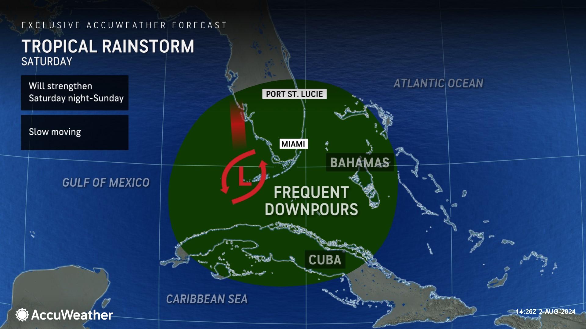
> Tropical threat will likely intensify into a tropical storm or potentially a
hurricane before making landfall along the Gulf coast of Florida this weekend

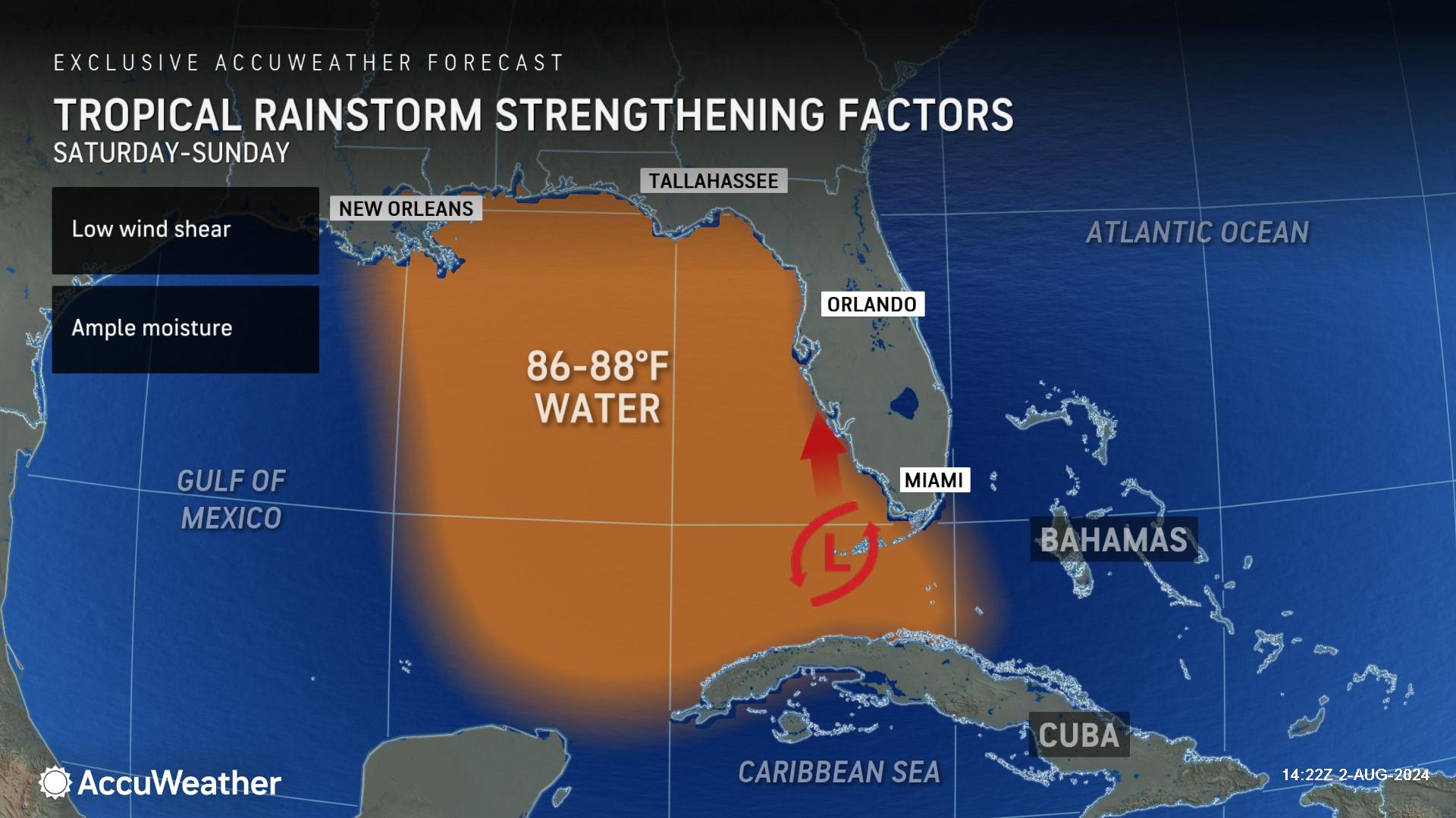
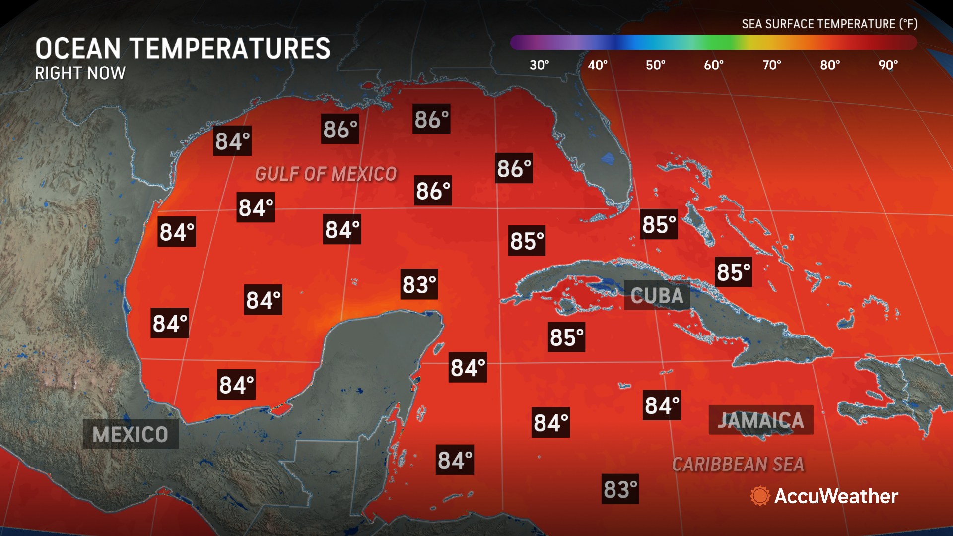
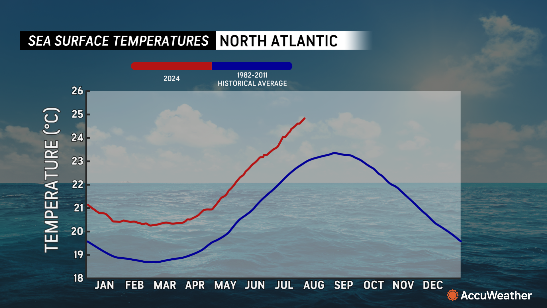
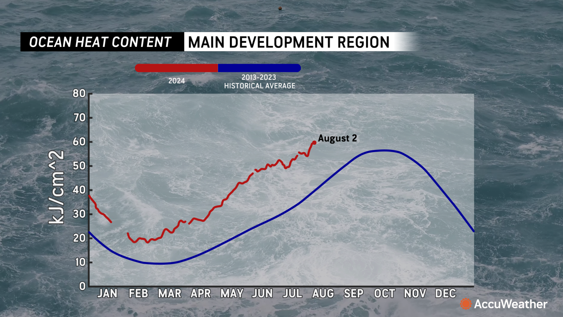
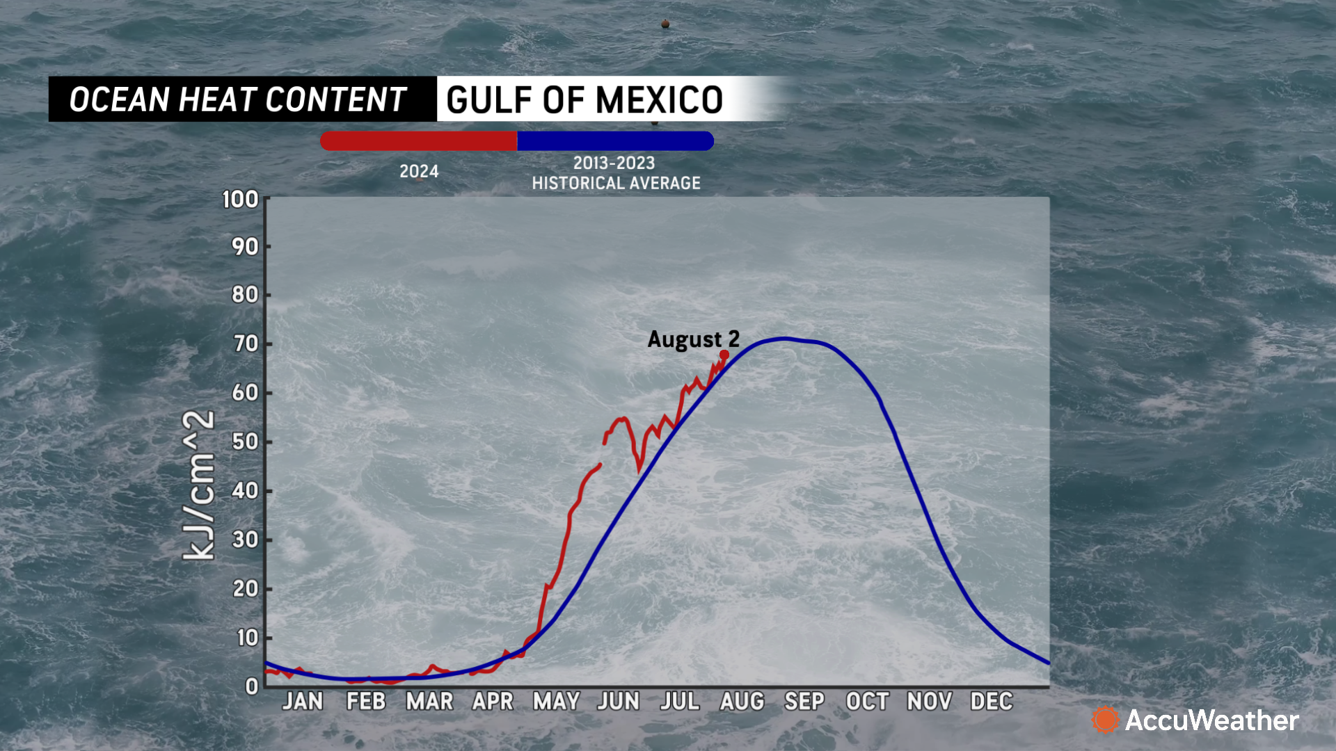
> High water temperatures and conducive conditions are raising the risk of
potential rapid intensification

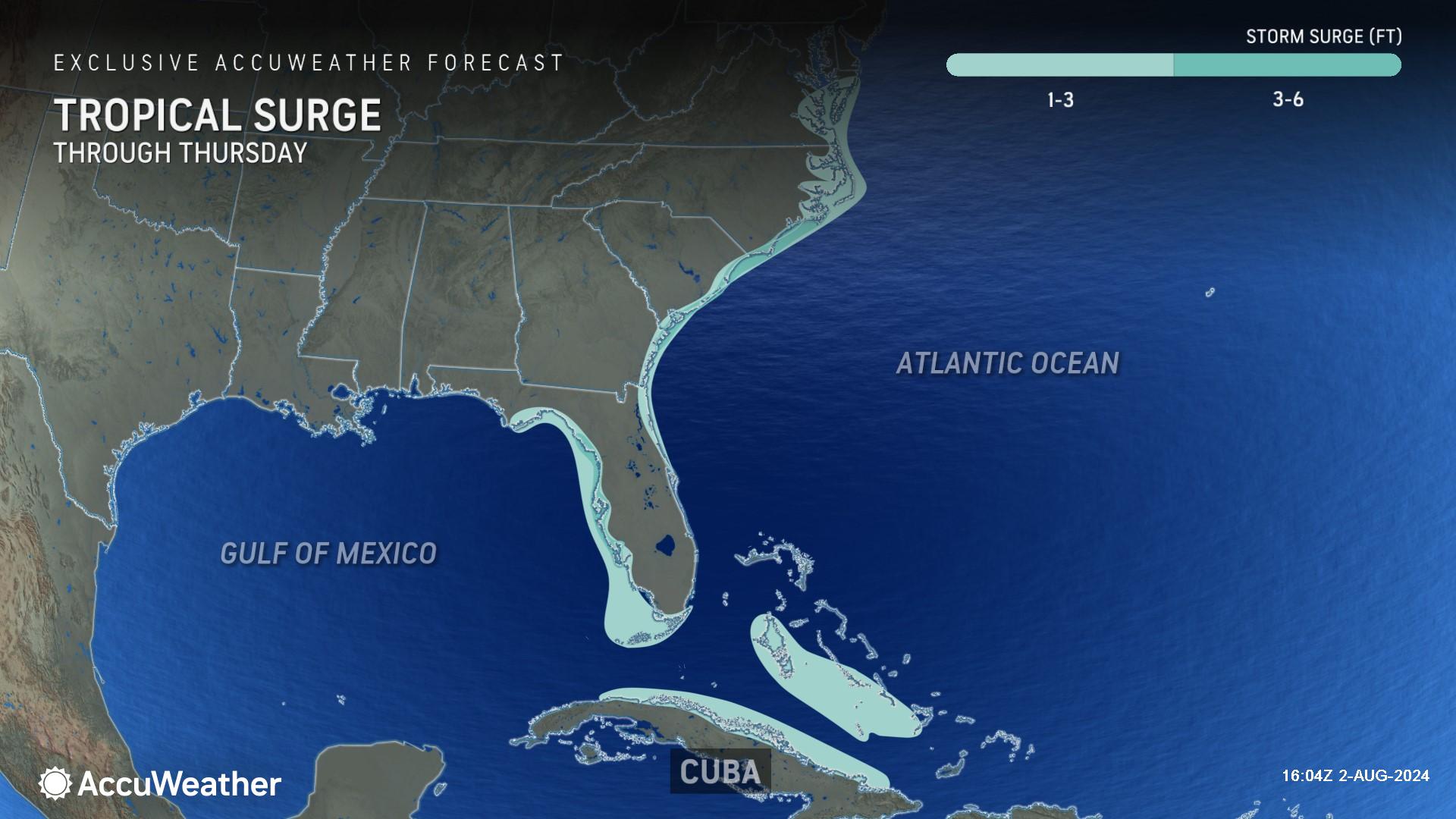
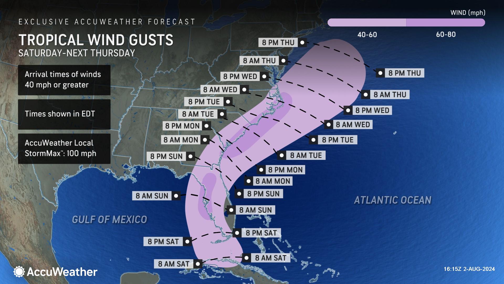
> Major flooding impacts along with storm surge and strong winds are possible
along the Southeast coast early next week
AccuWeather Global Weather Center – August 2, 2024
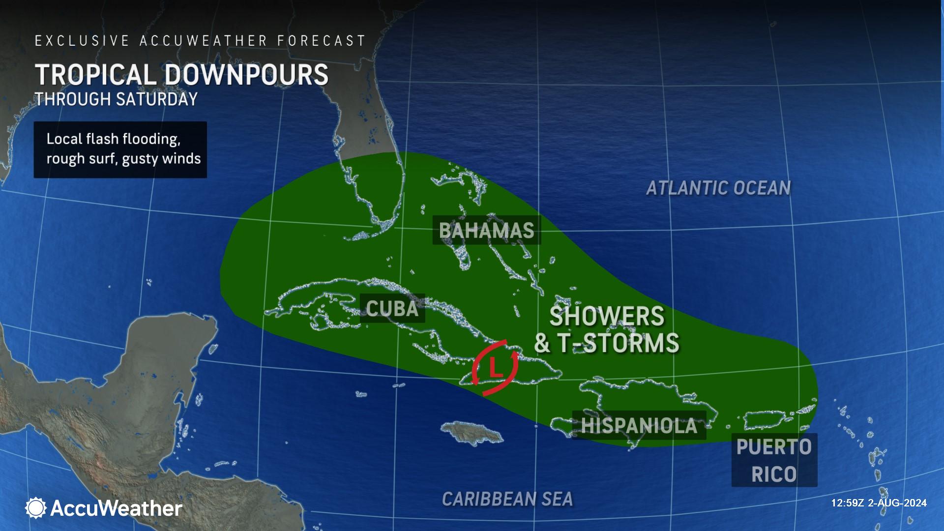
AccuWeather expert meteorologists say families and businesses across Florida, as well as eastern Georgia, North Carolina and South Carolina, need to prepare for the potential of flooding rainfall from a tropical rainstorm that is currently moving through the Caribbean.
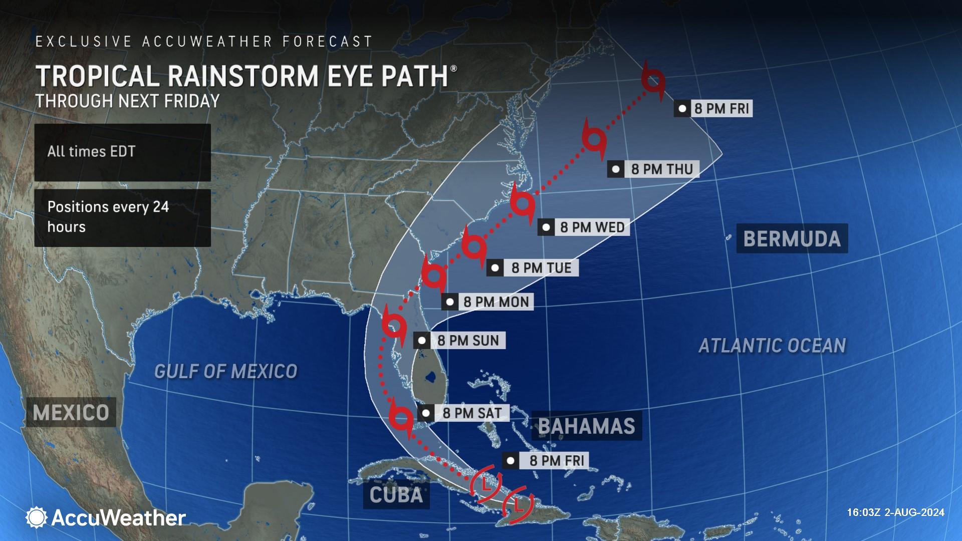
The team of hurricane experts at the AccuWeather Global Weather Center issued its first AccuWeather Tropical Rainstorm Eye Path® for this tropical threat on Thursday evening. AccuWeather was the first known source to provide a forecast track and related impacts to the public.
AccuWeather expert meteorologists refer to certain developing tropical threats as tropical rainstorms to raise awareness about the disruptions, damage and dangers that a system could pose before it becomes a named storm.
Focus on Florida Impacts
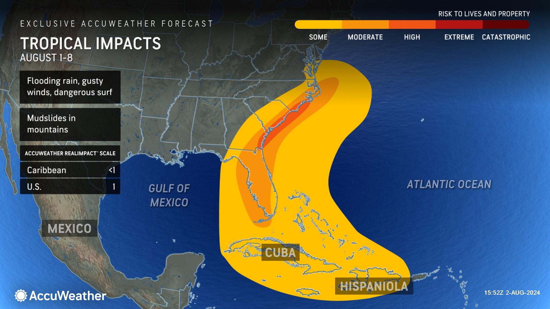
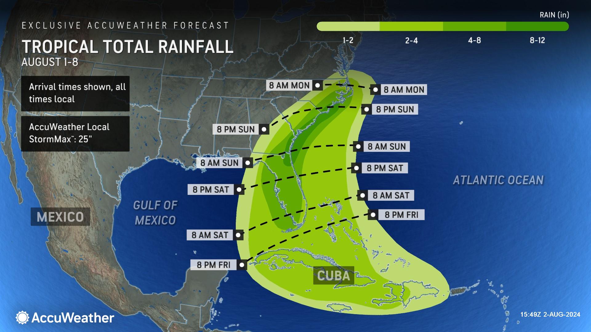
Eastern Georgia, South Carolina and parts of North Carolina could receive 8 to 12 inches of rain from Sunday through next week. AccuWeather Chief Meteorologist Jon Porter says more than a foot of rainfall is possible if the storm slows down next week, which could create life-threatening flooding. The AccuWeather Local StormMax™ for this area is 25 inches of rainfall.
“Everyone along the Gulf coast of Florida needs to be aware of potential landfall impacts. We could see damaging winds, flooding rainfall and extended power outages,” said Porter. “Don’t let your guard down in the Carolinas. This storm could slow down or even stall early next week and could bring hours of relentless downpours. Families and businesses in areas prone to flooding need to be prepared for the potential of major and potentially life-threatening flooding and closely monitor AccuWeather forecast updates over the weekend.”
AccuWeather expert meteorologists say rough surf and rip currents could create dangerous conditions at beaches across Florida, Georgia and the Carolinas. The risk of rip currents could extend along the East coast up through the Northeast and even parts of New England next week.
This tropical threat could also spin up tornadoes and waterspouts. Hurricane Beryl was a prolific tornado producer when it made landfall in Texas last month. Dozens of tornadoes were reported as Beryl moved inland from the Gulf Coast through upstate New York.
This storm is rated a 1 on the AccuWeather RealImpact™ Scale for Hurricanes for the United States, which warns of localized flooding, damage to unanchored mobile homes, power outages and coastal inundation that can cause property damage.
In contrast to the Saffir-Simpson Hurricane Wind Scale, which classifies storms by wind speed only, the AccuWeather RealImpact™ Scale is based on a broad range of important factors. In order to better communicate a more comprehensive representation of the potential impact of a storm to lives and livelihoods, the scale covers not only wind speed, but also flooding rain, storm surge and economic damage and loss. Some of these hazards such as inland flooding and storm surge in many storms result in more deaths and economic loss than wind.
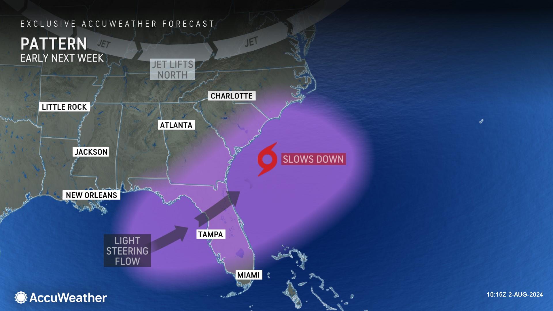
There is a risk that this storm could eventually be rated a 2 or even higher on AccuWeather's RealImpact™ Scale for Hurricanes. This higher rating would likely result from two scenarios. The first would be if the storm gains further wind intensity as it passes over the very warm water of the Gulf of Mexico prior to making landfall in Florida, which would increase wind, rain and storm surge impacts in Florida. The second scenario that would lead to a higher rating would be if the storm slows down to a point where it is hardly moving near the Southeast coast into next week. Impacts could be greatly amplified and would occur over a long period of time, including significant beach erosion and coastal flooding as well as major flooding from persistent heavy rainfall.
Will impacts reach the mid-Atlantic and Northeast?
Should steering breezes remain steady, due to a dip in the jet stream in the Northeast, this tropical threat may eventually be pushed enough to be drawn northward along the mid-Atlantic and New England coasts or possibly farther offshore over the Atlantic.
"Either way, there is the potential for the system to regain strength over the Atlantic early next week after its land interaction with Florida," said DaSilva. "That could mean it may become a hurricane for the first time or regain hurricane status if it strengthens before reaching Florida in the first place."
From Tuesday to Thursday, tropical moisture may interact with a non-tropical storm in the Northeast. That interaction may result in excessive rainfall and flooding well north and west, away from or removed from the tropical threat itself.
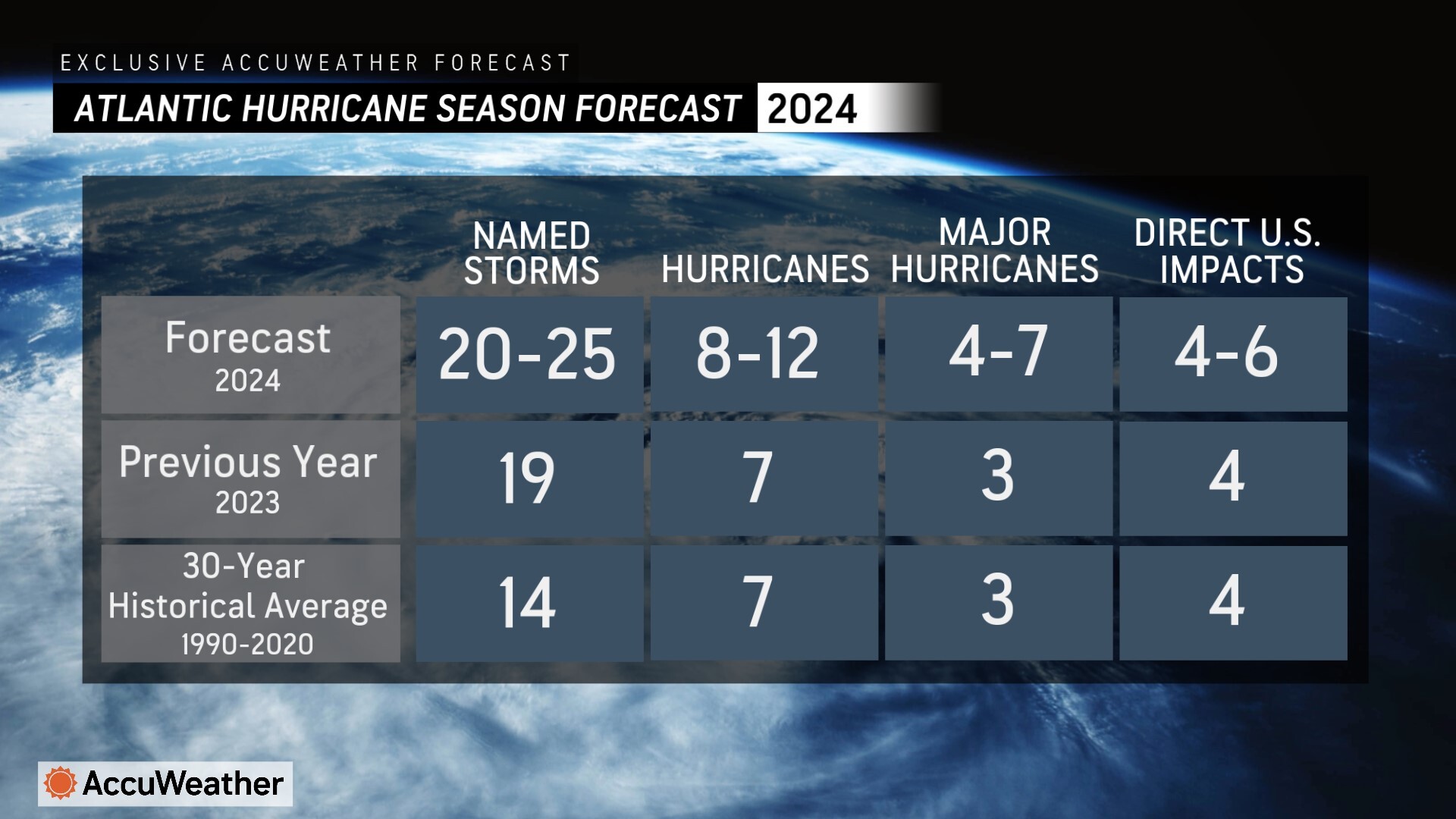
Explosive hurricane season ahead
|
AccuWeather expert meteorologists have not wavered from their prediction of an explosive hurricane season since their first forecast was issued in March, before other known sources. |
AccuWeather Forecast Graphics
Additional AccuWeather Resources:


