


AccuWeather meteorologists are available 24/7 to provide further insights and updates on evolving weather conditions. Please contact pr@accuweather.com during regular business hours, or support@accuweather.com or call AccuWeather’s Media Hotline at (814)-235-8710 at any time to arrange interviews with AccuWeather experts or to request the most updated graphics for print or broadcast.
AccuWeather is forecasting a hurricane landfall in Florida, widespread flooding impacts possible across the Southeast
August 3, 2024

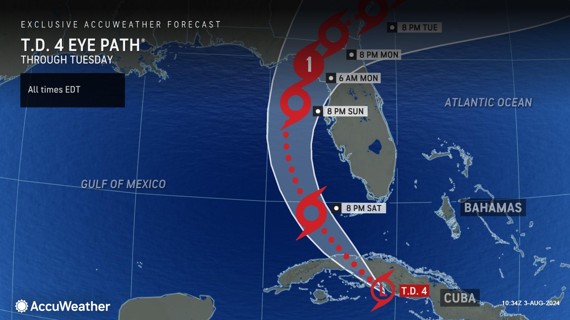
> AccuWeather expert meteorologists are forecasting a Category 1 hurricane
to make landfall in the Big Bend region of Florida early Monday morning.
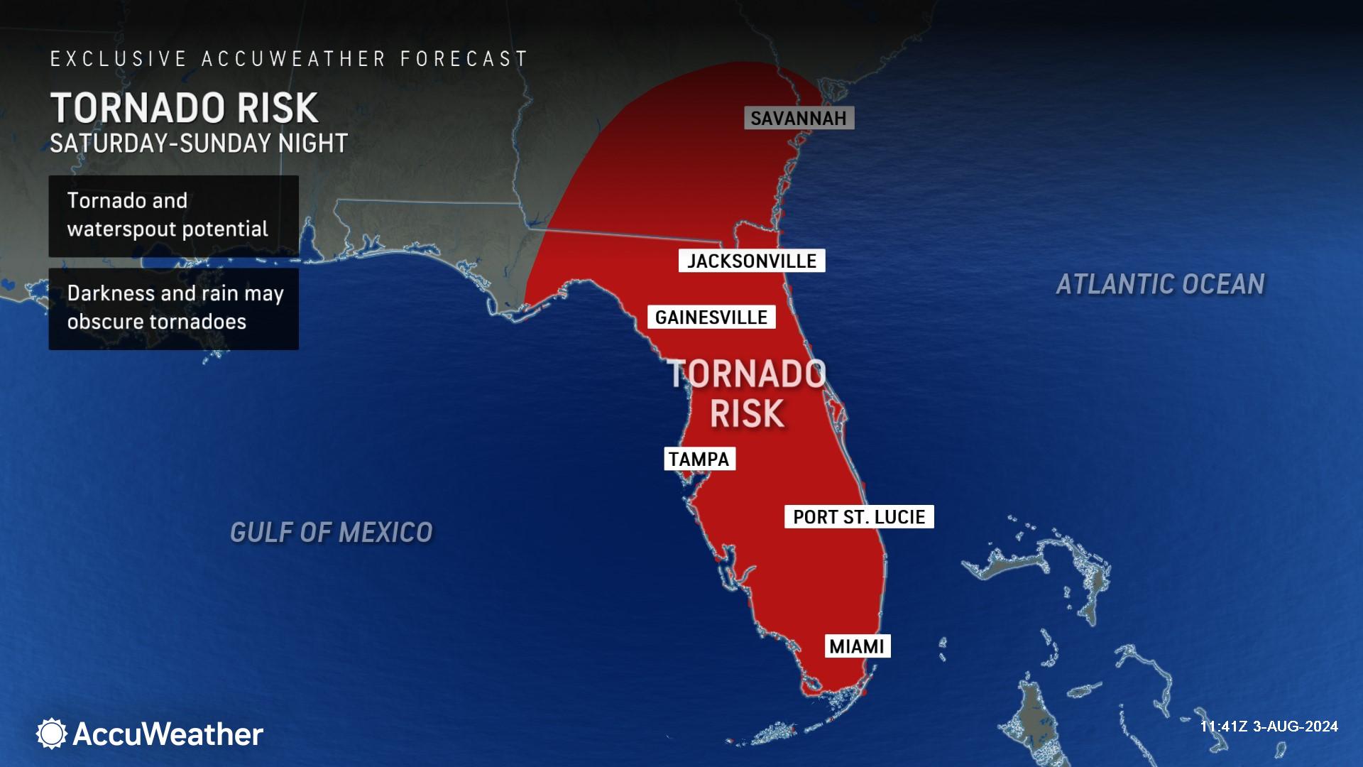
> Growing risk of tornadoes and waterspouts throughout the Florida peninsula
this weekend.
> Rainfall totals could exceed 12 to 18 inches along the Southeast U.S. coast
next week, posing a major flooding and public safety risk.
AccuWeather Global Weather Center – August 3, 2024
Families, businesses and officials along the Gulf coast of Florida are being urged to prepare for impacts from a hurricane landfall early Monday morning in the Big Bend region.
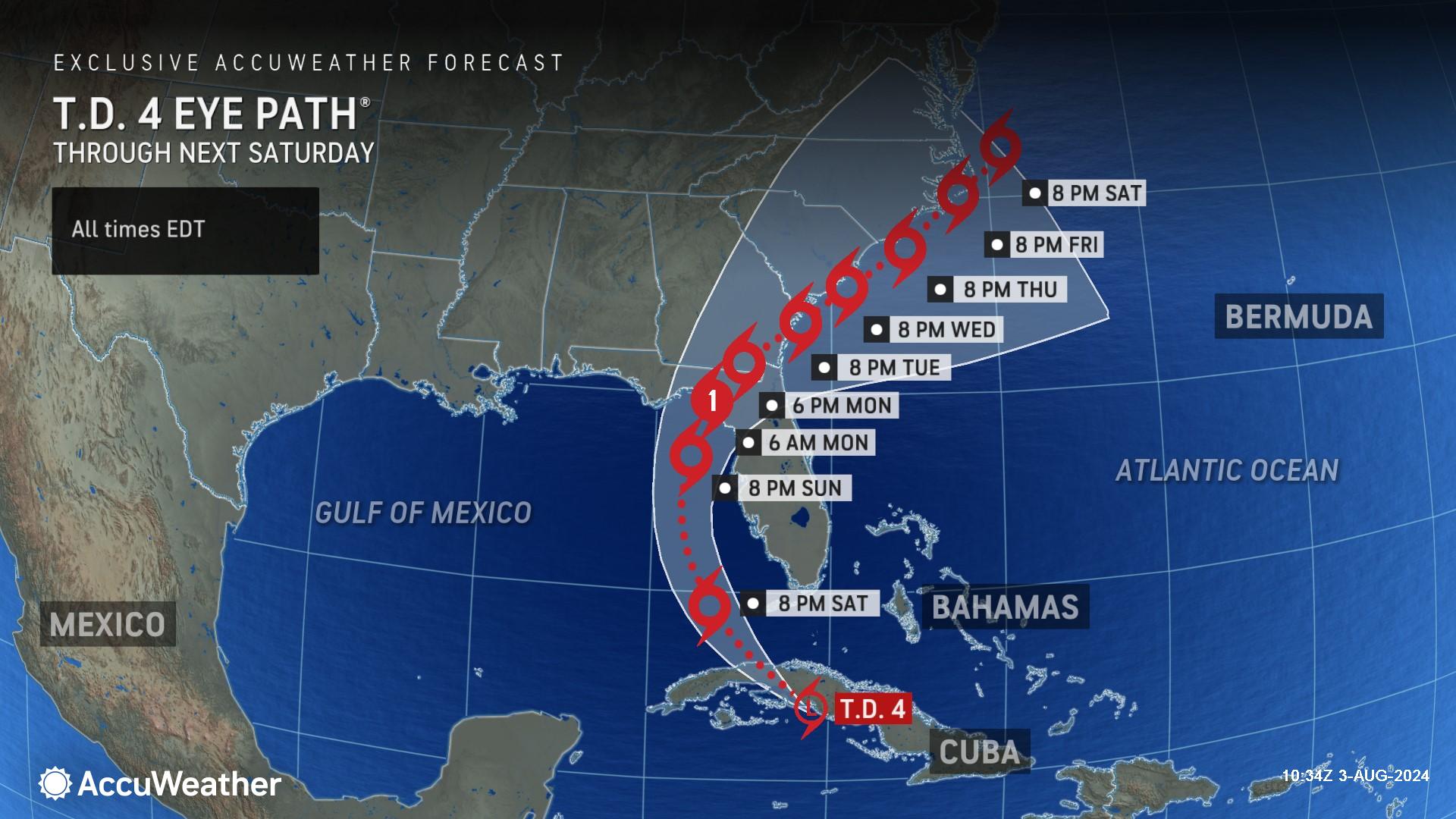
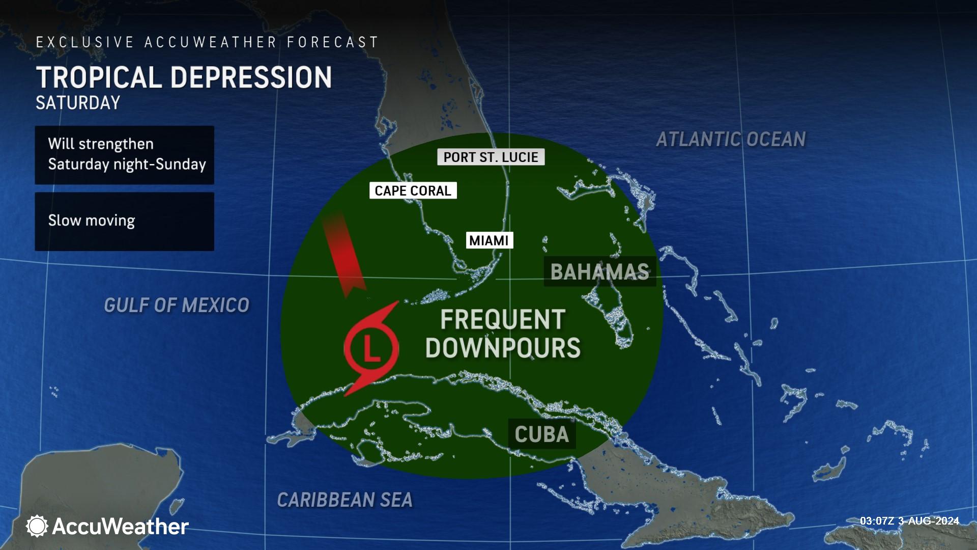
AccuWeather expert meteorologists are forecasting the tropical depression moving through the Caribbean Saturday to strengthen into a tropical storm over the warm waters of the eastern Gulf of Mexico in the next 24 hours. The tropical storm is forecast to strengthen further over the weekend before making landfall as a Category 1 hurricane with maximum sustained winds of 74-95 mph on the Saffir-Simpson Hurricane Wind Scale early Monday morning.
The next name of the Atlantic storm list is Debby.
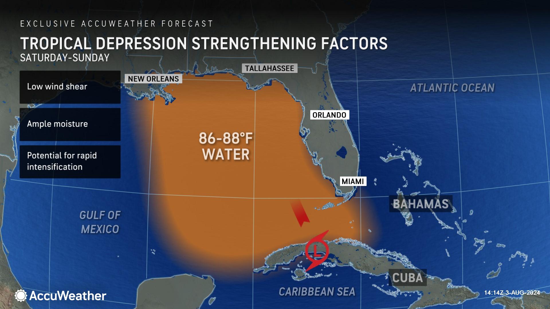
“Tropical Depression Four made a jog to the south of Cuba early Saturday morning, allowing the storm to further organize before entering into the Gulf of Mexico. The storm is expected to be lifted north through this weekend into the eastern Gulf of Mexico, where water temperatures are well above their historical average, and into a zone with very light wind shear,” said AccuWeather Meteorologist Brandon Buckingham. “The combination of these factors opens up the possibility of rapid intensification between Saturday night and early Monday morning, including the final hours right up to the point of landfall.”
Buckingham warns that there is the potential for this tropical depression to rapidly intensify into a Category 2 hurricane before making landfall in Florida.
Prepare for hurricane impacts in Florida
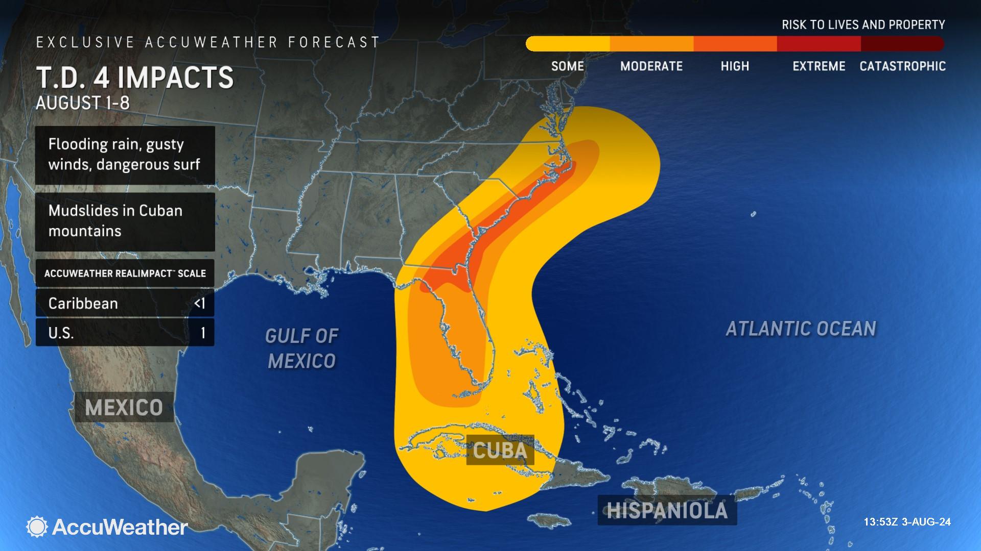
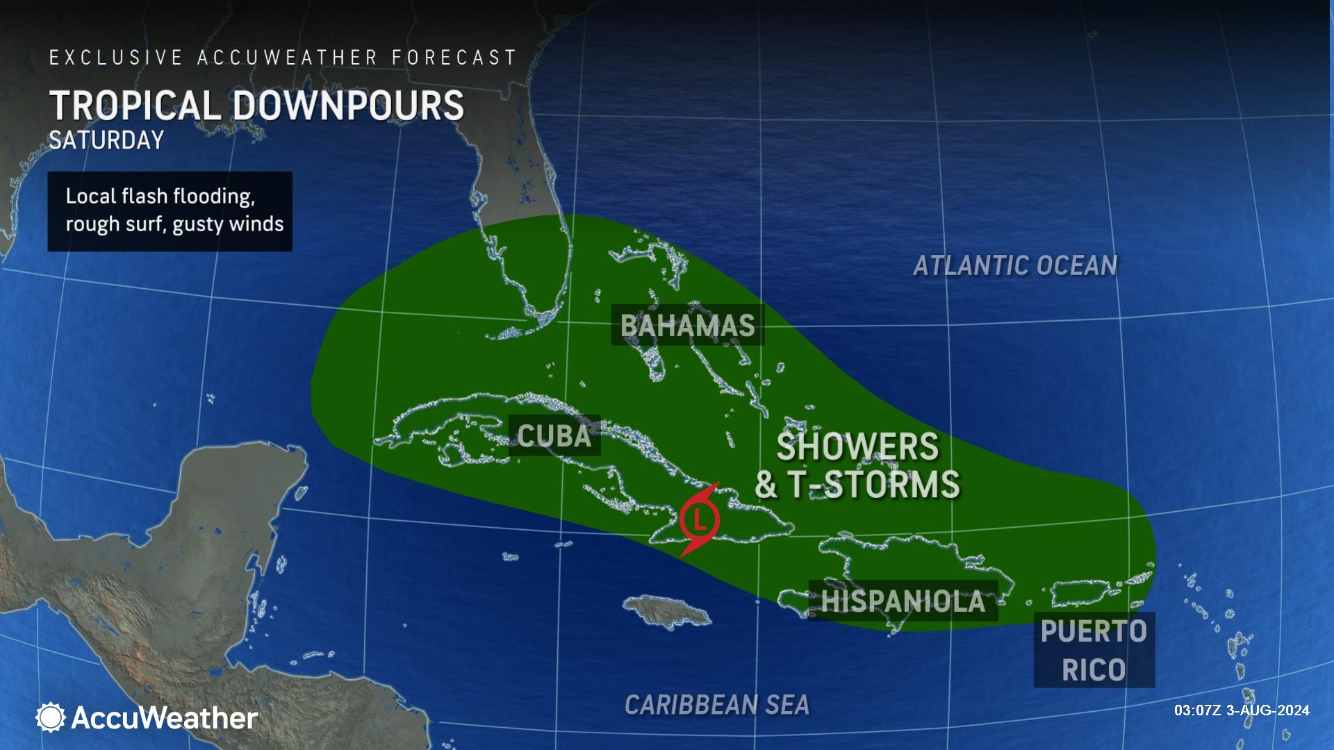
Rounds of rain and gusty thunderstorms will spread northward over the Florida Peninsula on Saturday and expand throughout the weekend. AccuWeather expert meteorologists warn that this tropical threat could spin up tornadoes over land and waterspouts over water.
AccuWeather Chief Meteorologist Jon Porter says families across Florida should be prepared for the threat of nocturnal tornadoes, which pose a greater threat since they are obscured by darkness and many people are sleeping.
“Have your shelter or safe place ready for tornado warnings. You want to be able to move there quickly, especially with an overnight threat. You want to be in the lowest part of your home, ideally an interior room away from external walls, windows and doors,” said Porter. “Most people are sleeping at night. Tornadoes that happen at night are two times more likely to be fatal than tornadoes that occur during the day; that’s why it’s such a concern.”
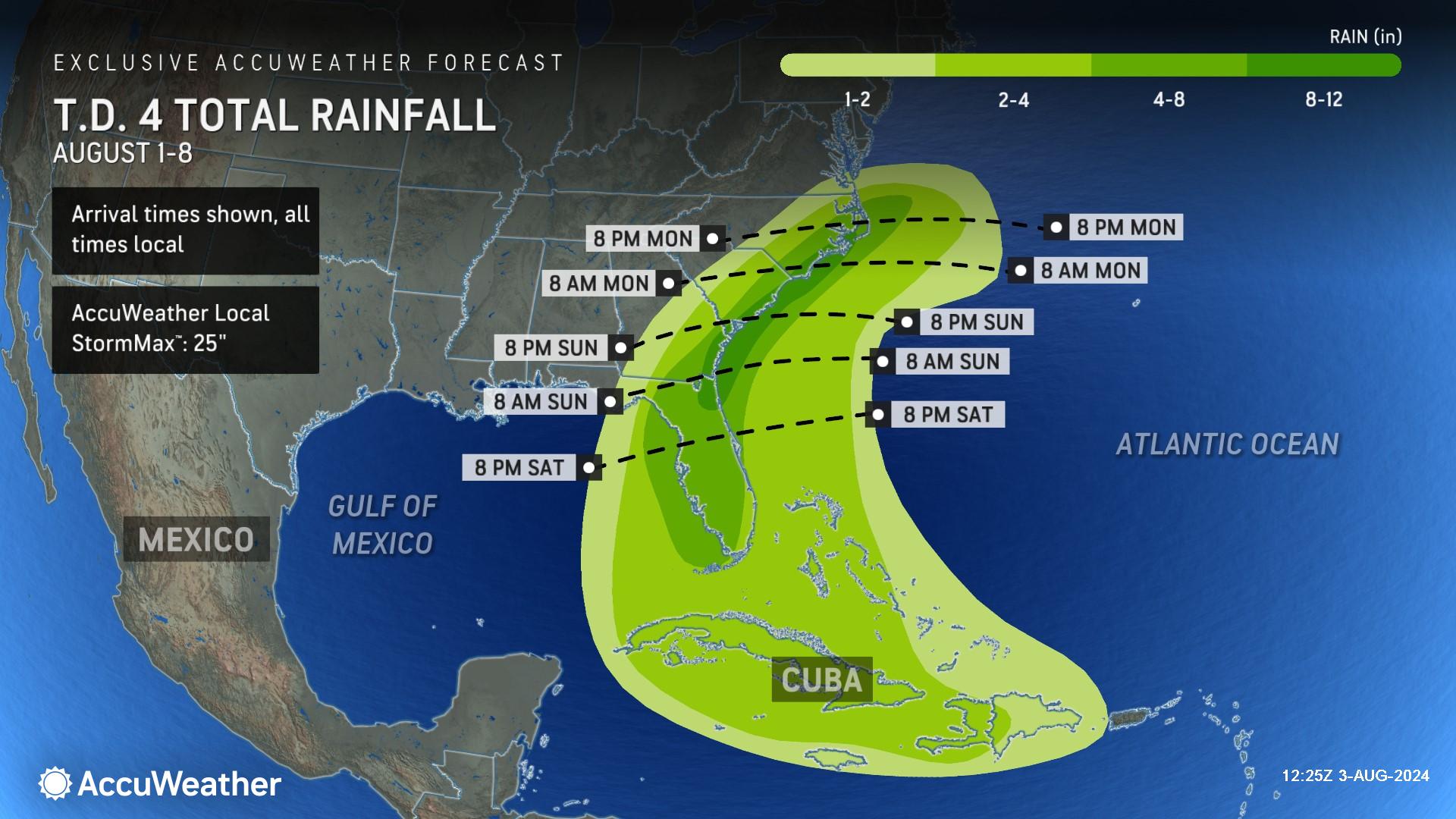
AccuWeather expert meteorologists are forecasting 4-8 inches of rainfall across the Florida peninsula and 8 -12 inches of rainfall in northeast Florida. More than a foot of rain is possible.
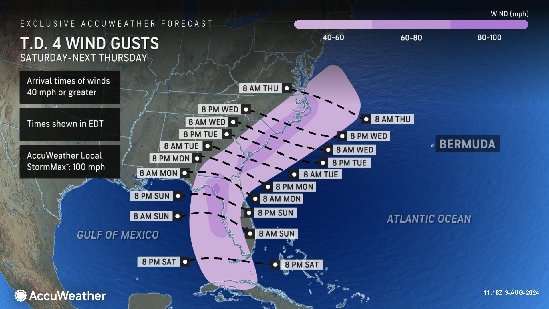
Wind gusts of 60-80 mph are possible late Sunday into Monday as this tropical threat approaches the Big Bend region of Florida. The AccuWeather Local StormMax™ for wind gusts is 100 mph.
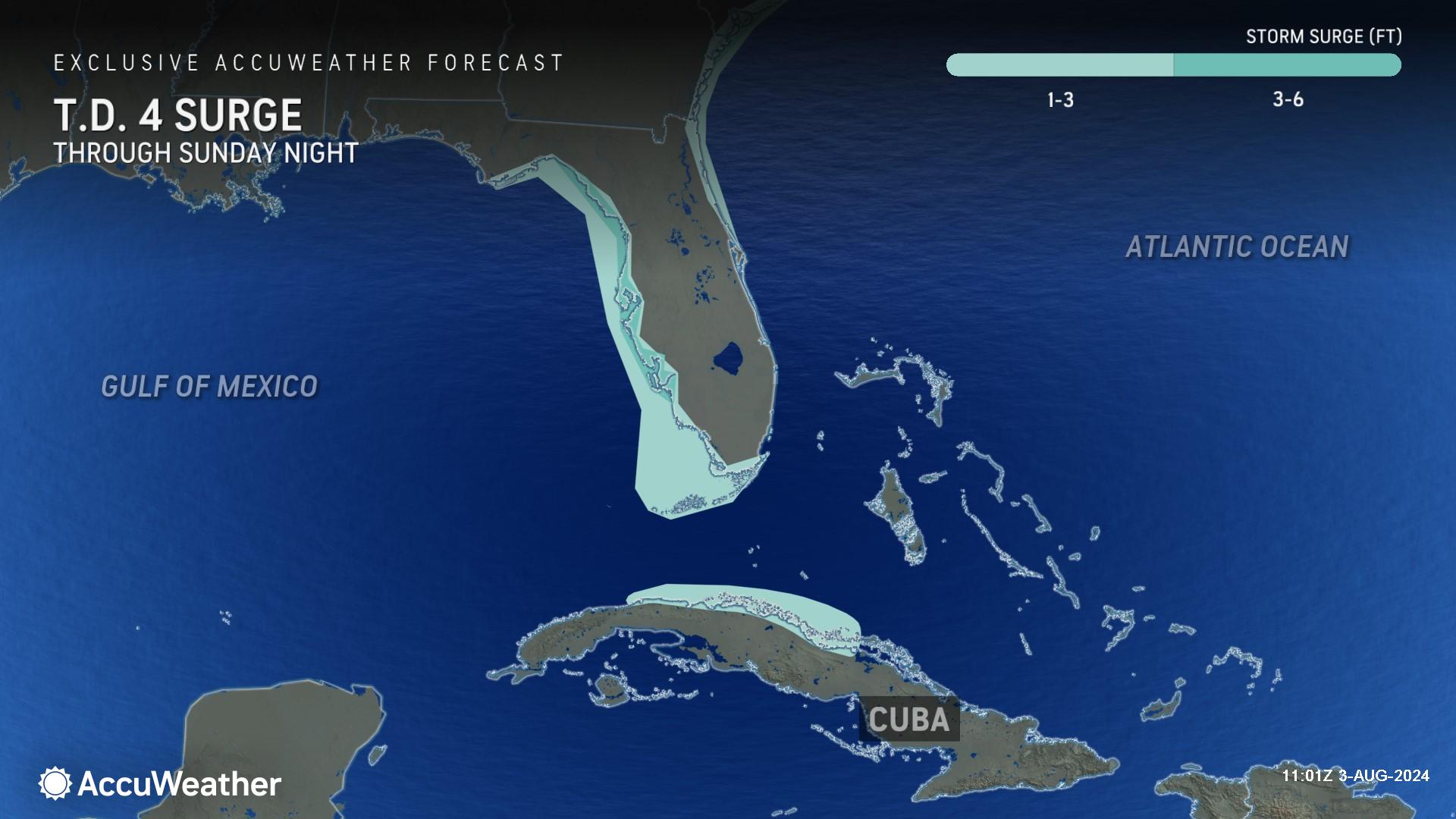
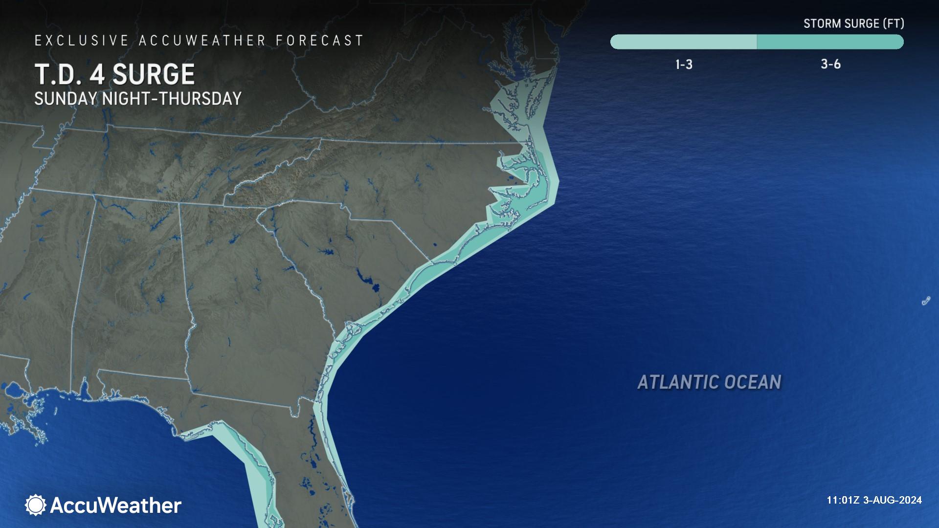
AccuWeather expert meteorologists warn that 3 -6 feet of storm surge are possible along the Gulf Coast of Florida from the Big Bend region, through Tampa Bay, and as far south as Fort Myers Beach. Storm surge of 1-3 feet is possible in far southwestern Florida and the Florida Keys, as well as the Atlantic coast of Florida from Miami through Jacksonville.
Rough surf and dangerous rip currents are expected, which could create hazardous beach conditions before the tropical threat and downpours reach the coastline.
Flooding risk increasing across the Southeast
Following a landfall in Florida, AccuWeather expert meteorologists say there is a growing threat of relentless rainfall and flooding impacts as the storm moves inland and toward the Atlantic coast of the Southeast U.S.
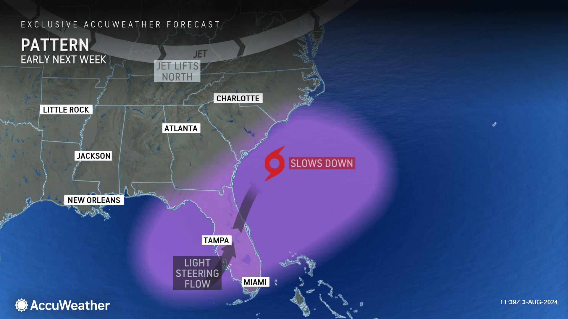
“After the expected landfall in the Big Bend region of Florida early Monday morning, the storm is expected to track northeastward, then slow down along the Southeast coast early next week,” explained Buckingham. “Upper-level winds, which typically steer tropical storms and hurricanes, will be very light within this zone, which can cause the storm to nearly stall out for a time. Depending on the exact location of the storm in proximity to the Southeast coast, a prolonged, potentially multi-day period of heavy rain, strong wind gusts and persistent onshore flow are all possible from coastal Georgia through the coastal Carolinas.”
AccuWeather expert meteorologists say 8-12 inches of rain are possible from Jacksonville, Florida, through coastal Georgia, South Carolina, and parts of coastal North Carolina. The AccuWeather Local StormMax™ for rainfall is 25 inches. Families and businesses in areas prone to flooding are encouraged to prepare for the potential of impactful and life-threatening flooding next week and to closely monitor AccuWeather forecast updates.
Rough surf and dangerous rip currents are possible at beaches along the Atlantic coastline next week from Florida through Virginia, possibly expanding as far north as the Northeast.
This storm is rated a 1 on the AccuWeather RealImpact™ Scale for Hurricanes for the United States, which warns of localized flooding, damage to unanchored mobile homes, power outages and coastal inundation that can cause property damage.
In contrast to the Saffir-Simpson Hurricane Wind Scale, which classifies storms by wind speed only, the AccuWeather RealImpact™ Scale is based on a broad range of important factors. In order to better communicate a more comprehensive representation of the potential impact of a storm to lives and livelihoods, the scale covers not only wind speed, but also flooding rain, storm surge and economic damage and loss. Some of these hazards such as inland flooding and storm surge in many storms result in more deaths and economic loss than wind.
“There is a risk that this storm eventually may need to be rated a 2 or even higher on AccuWeather’s RealImpact™ Scale for Hurricanes,” said Porter. “This higher rating would likely result from two scenarios. The first would be if the storm gains further wind intensity as it passes over the very warm water of the Gulf of Mexico before making landfall in Florida, which would increase wind, rain and storm surge impacts in Florida. The second scenario that would lead to a higher rating would be if the storm slows down to a point where it is hardly moving near the Southeast coast into next week. Impacts could be greatly amplified and would occur over a long period of time, including significant beach erosion and coastal flooding as well as major flooding from persistent heavy rainfall."
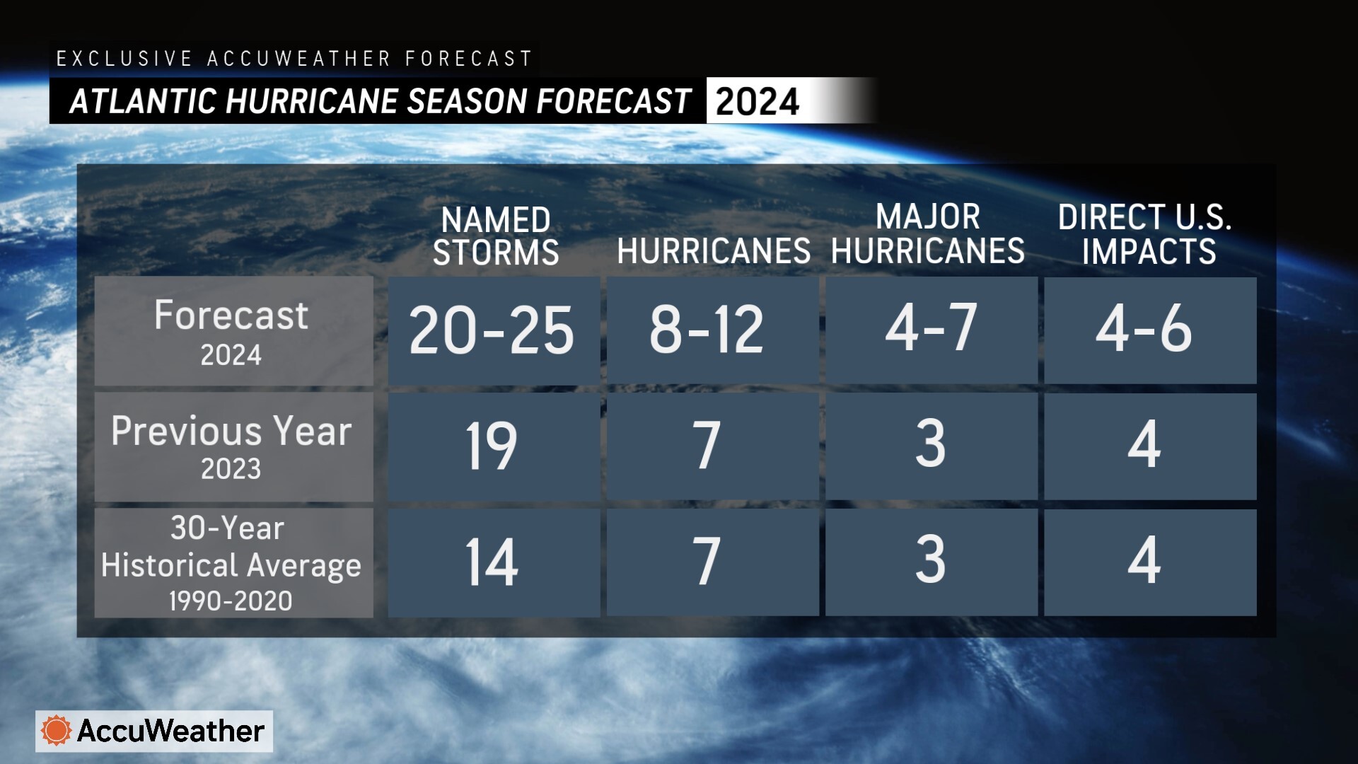
The team of expert meteorologists at AccuWeather’s Global Weather Center are forecasting an “explosive” hurricane season in the Atlantic basin, with 20-25 named storms and 4-6 direct impacts on the United States.
AccuWeather expert meteorologists issued a warned in May about the growing threat of rapidly intensifying storms near coastal cities this year due to usually warm sea surface temperatures, as well as other conditions that are conducive for tropical development and intensification. Rapidly intensifying tropical storms and hurricanes near coastal areas can leave families, businesses and government leaders with less time to react and prepare.
AccuWeather Forecast Graphics
Additional AccuWeather Resources:
Upcoming tropical storm has Florida, southeast US on alert
AccuWeather Hurricane Tracking & Storm Radar
Hurricane season: AccuWeather's guide for first-timers
How to use a generator safely after a hurricane strikes
AccuWeather Forecasts Explosive 2024 Hurricane Season
Category 5 Hurricane Beryl rewrites the record books
Rapidly Intensifying Hurricanes Near Coastline Pose Major Threat To US This Season
How to avoid the potentially deadly grip of a rip current


