AccuWeather meteorologists are available 24/7 to provide further insights and updates on evolving weather conditions. Please contact pr@accuweather.com during regular business hours, or support@accuweather.com or call AccuWeather’s Media Hotline at (814)-235-8710 at any time to arrange interviews with AccuWeather experts or to request the most updated graphics for print or broadcast.
‘Extreme Risk’ For Destructive Tornadoes In Central U.S.
|
|||||||||||
May 6, 2024
AccuWeather Global Weather Center – May 6, 2024
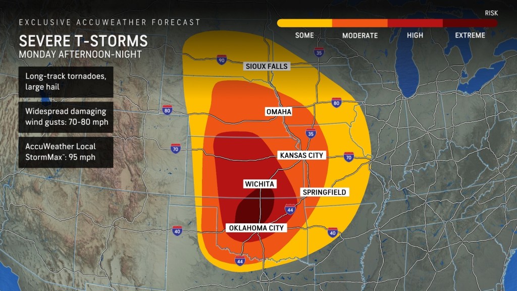
AccuWeather expert meteorologists say this area of the Plains faces the greatest threat of destructive long-track tornadoes, large hail, and powerful wind gusts.
“It’s a dangerous day,” said AccuWeather Chief Meteorologist Jon Porter. “Not every area under an ‘extreme risk’ will see storms today, but the storms that do develop will have the potential for strong tornadoes. Today is the most widespread, significant risk for strong tornadoes in the Southern Plains in the last 5 years.”
Porter says there are also growing concerns about the threat for nocturnal tornadoes.
“This extreme risk for severe storms lasts well into the night as it evolves into a line of thunderstorms with embedded tornadoes. The line of storms will blast east across Kansas and Oklahoma toward Kansas City and Springfield, Missouri tonight,” said Porter. “Nocturnal tornadoes are extremely dangerous. Tornadoes can be nearly impossible to see in the dark, especially if they’re wrapped in rain. Navigating through tornado damage in the dark is also extremely dangerous for storm survivors and first responders. Everyone in this area needs to keep their cell phone charged, notifications turned on, and volume turned up, so they do not sleep through a tornado warning.”
It is critical that people who live and work in areas threatened by severe weather have access to a shelter or safe room and have multiple ways to receive weather alerts.
AccuWeather expert meteorologists first issued an alert about a looming tornado outbreak in the Central United States on March 2.
Storms Shift East Throughout The Week
The threat of severe weather shifts to the north and east on Tuesday. AccuWeather expert meteorologists say there is a ‘moderate risk’ for isolated tornadoes, hail, and damaging wind gusts in the Mississippi and Ohio valleys.
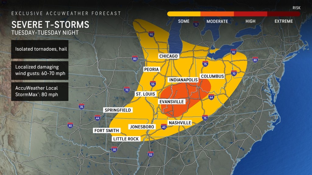
The Chicago, Indianapolis, and Cincinnati metro areas are included in the risk for severe thunderstorms on Tuesday.
The threat for severe weather intensifies in a similar region on Wednesday.
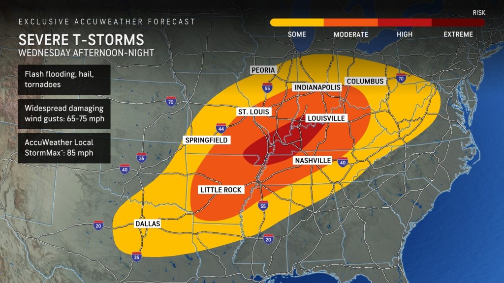
AccuWeather expert meteorologists have issued a ‘high risk’ for severe thunderstorms that could bring tornadoes, hail, and flash flooding Wednesday afternoon and through the night.
Far northeast Arkansas, southwest Missouri, southern Illinois, southwest Indiana, western Kentucky, and far northwest Tennessee are included in the ‘high risk’ for tornadoes, flash flooding, and hail on Wednesday.
The threat for severe thunderstorms will shift to the east and south on Thursday.
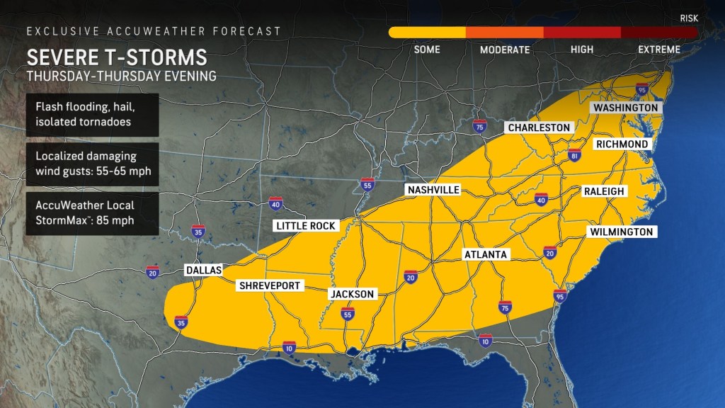
The risk of storms that could lead to flash flooding, hail, and isolated tornadoes will extend from east Texas, along the Gulf Coast states, up through the Mid-Atlantic and Washington D.C. on Thursday.
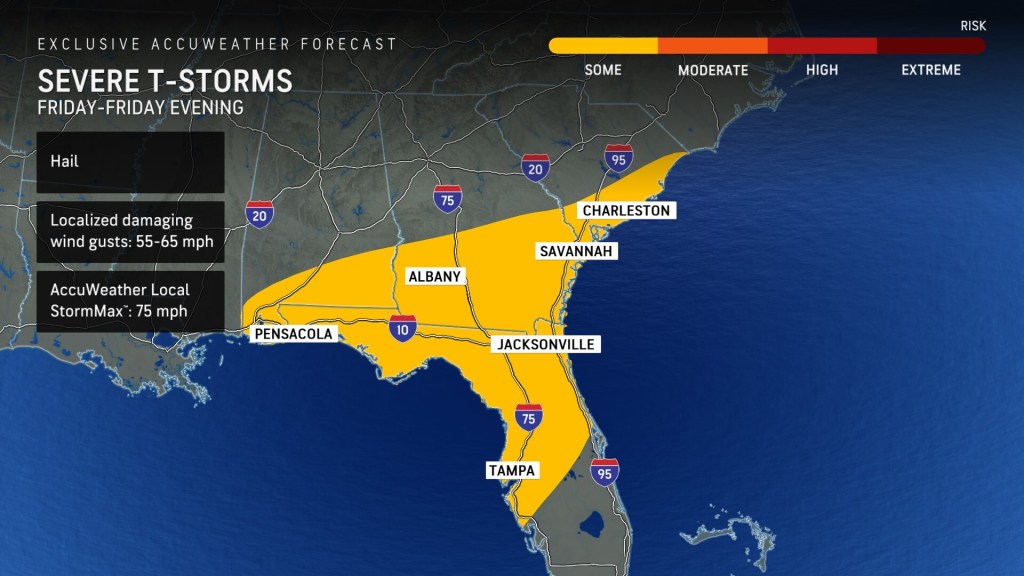
Storms will shift southeast on Friday, with the risk of severe thunderstorms from the Carolinas through Central Florida and the Tampa Bay region.
Additional AccuWeather Resources:


